Asset Mapping
Obtain highly detailed models that can be used to measure the finest details about different roadway assets
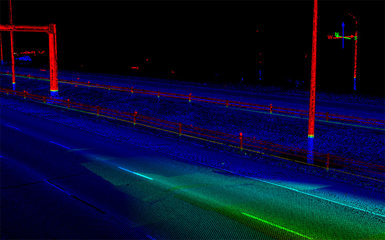
Compared to other surveying methods, Nektar 3D Mobile Mapping’s LiDAR surveys can drastically reduce the amount of time spent collecting information and provide far more reliable results. Each point cloud contains a precise representation of your designated area with all surrounding objects. These point clouds can be used to extract inventoried item counts of roadway assets, such as traffic signs, utility poles, bridge structures and more. With efficient LiDAR scanning, you obtain the large-scale asset inventory you need with minimal public traffic disruption.
Mobile LiDAR technology can collect data at an extremely rapid rate while maintaining a high level of detail. This is one of its most powerful advantages. Thanks to the dual-scanner system owned by Nektar 3D Mobile Mapping, our scanners can collect up to two million points per second while travelling at highway speeds. The efficient and convenient survey process produces high-quality 3D point clouds, which can be utilized in the assessment of multiple roadway assets.
POTENTIAL APPLICATIONS
Large-scale Asset Extraction
For the purpose of large-scale assessments, Nektar 3D Mobile Mapping’s scanning processes simplify the collection of transportation assets. Instead of requiring multiple survey teams to collect information about multiple transportation assets, Nektar 3D collects state-of-the-art LiDAR scans to survey the corridor and generate high-quality data. The high-density LIDAR scans allowed Nektar 3D Mobile Mapping to extract precise asset alignments, locations, and positions along the corridor.