
Recent Projects

Highway 15 Construction Quantity Measurement
Client: Alberco Construction Ltd.
Contract Date: August, 2020
Distance: N/A
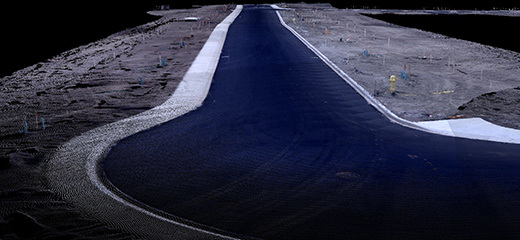
A time-critical assessment of existing earth stockpiles was required to provide quantities for pay items. Nektar 3D captured a photogrammetric scan to provide a quick survey of the existing stockpiles. We deployed our drone to collect the scan, which was then used to measure quantities. The scan was completed just in time prior to earthworks began.
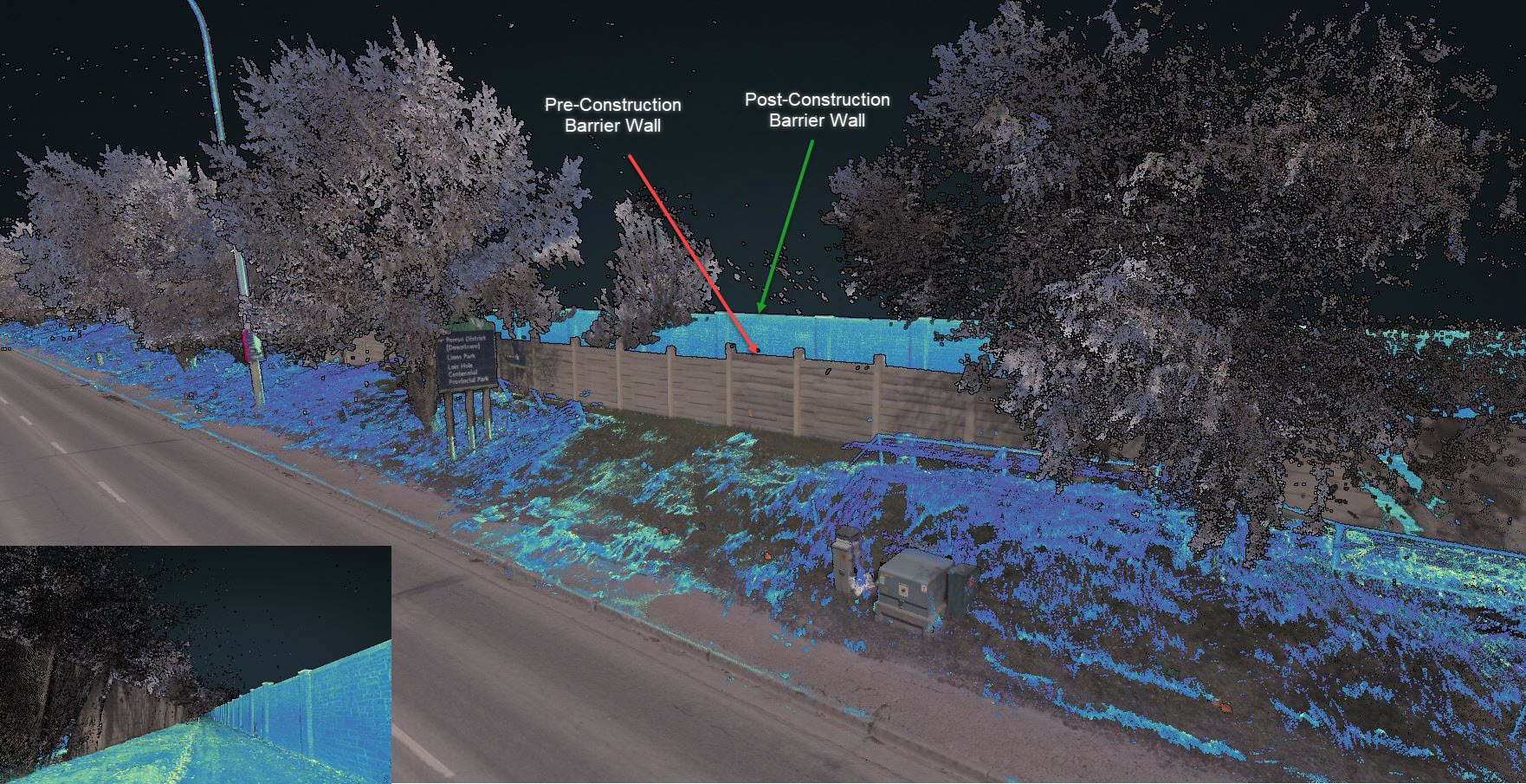
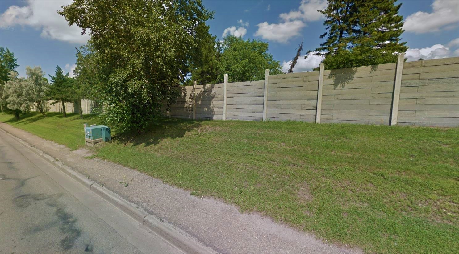
Grandin Barrier Wall (St. Albert)
Client: Wilco Contractors Northwest Inc.
Contract Date: April, 2019
Distance: N/A
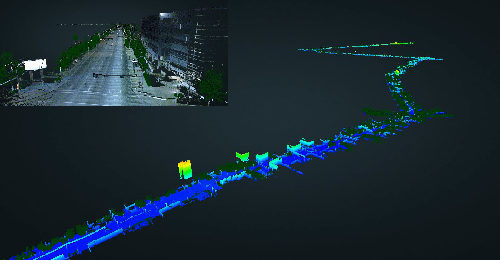
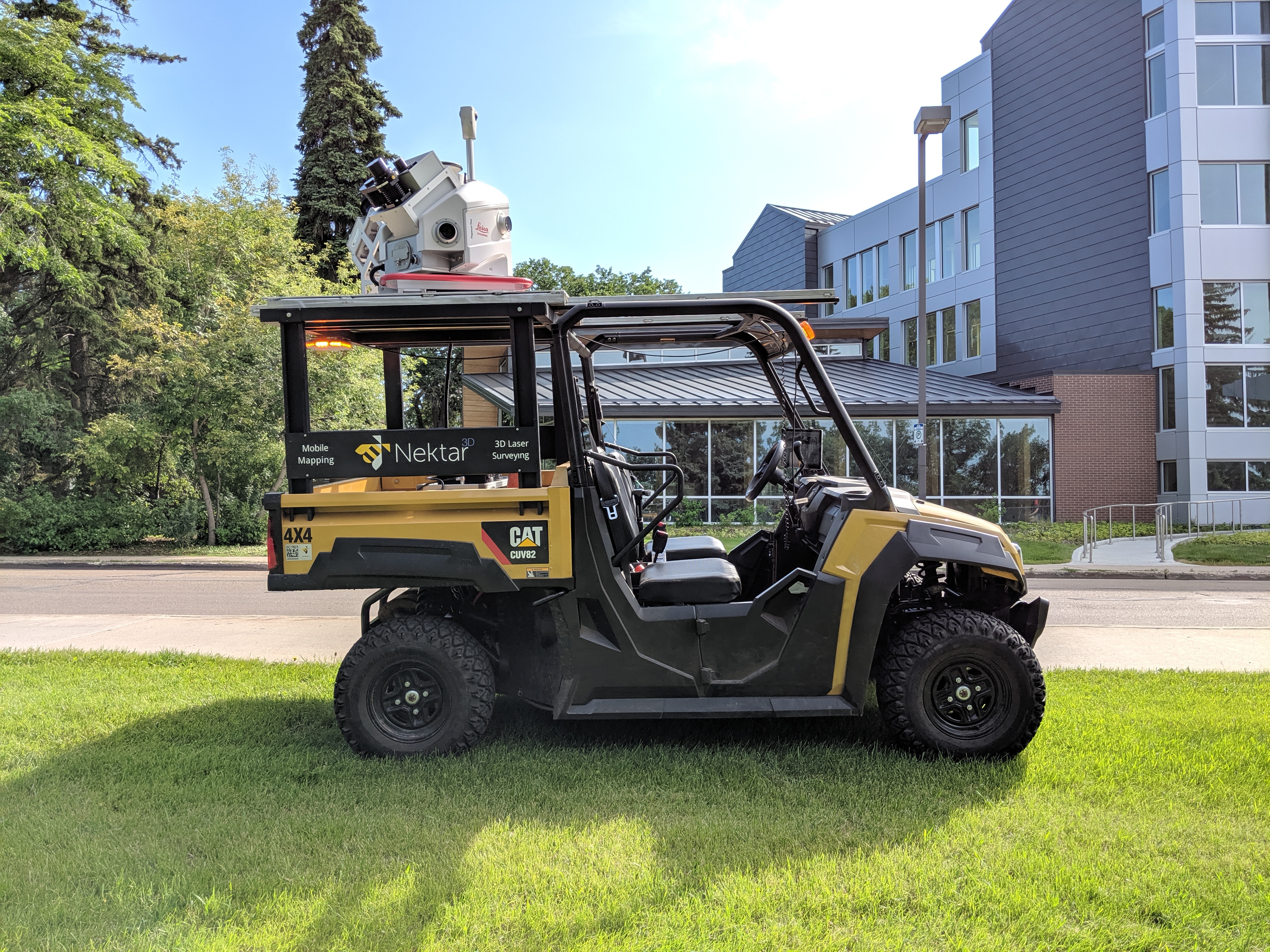
Truck-mounted mobile LiDAR was contracted to survey the noise barrier wall along St. Albert Trail bordering the Grandin neighbourhood. This was used to determine the location of the wall alongside the roadway and quantifies existing conditions along the wall and its surrounding area. Scans from the pre-construction and post construction stage were registered for documentation of site conditions.
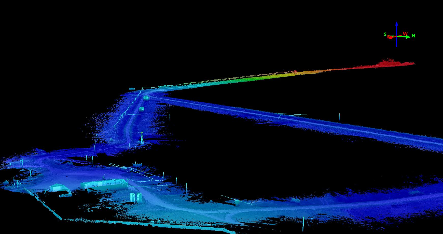
Miette Road Asset Identification and Surface Modelling
Client: ATCO Electric.
Contract Date: Oct, 2019
Distance: 9.8km
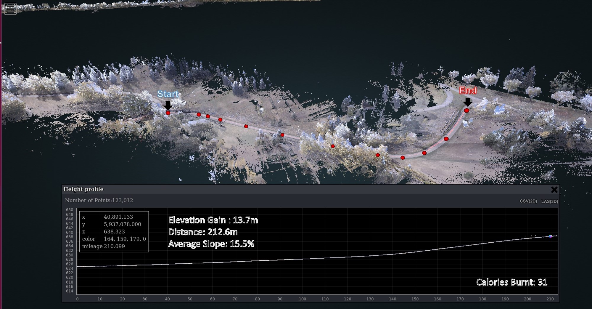
To aide planning efforts for new electrical infrastructure along Miette Road’s delicate and difficult roadside environment, Nektar3 D was contracted to provide an efficient mobile LiDAR scan of the 9.8-kilometer corridor prior to the snow fall. The project also involved using the LiDAR scans to generate accurate Digital Elevation models of the corridor.
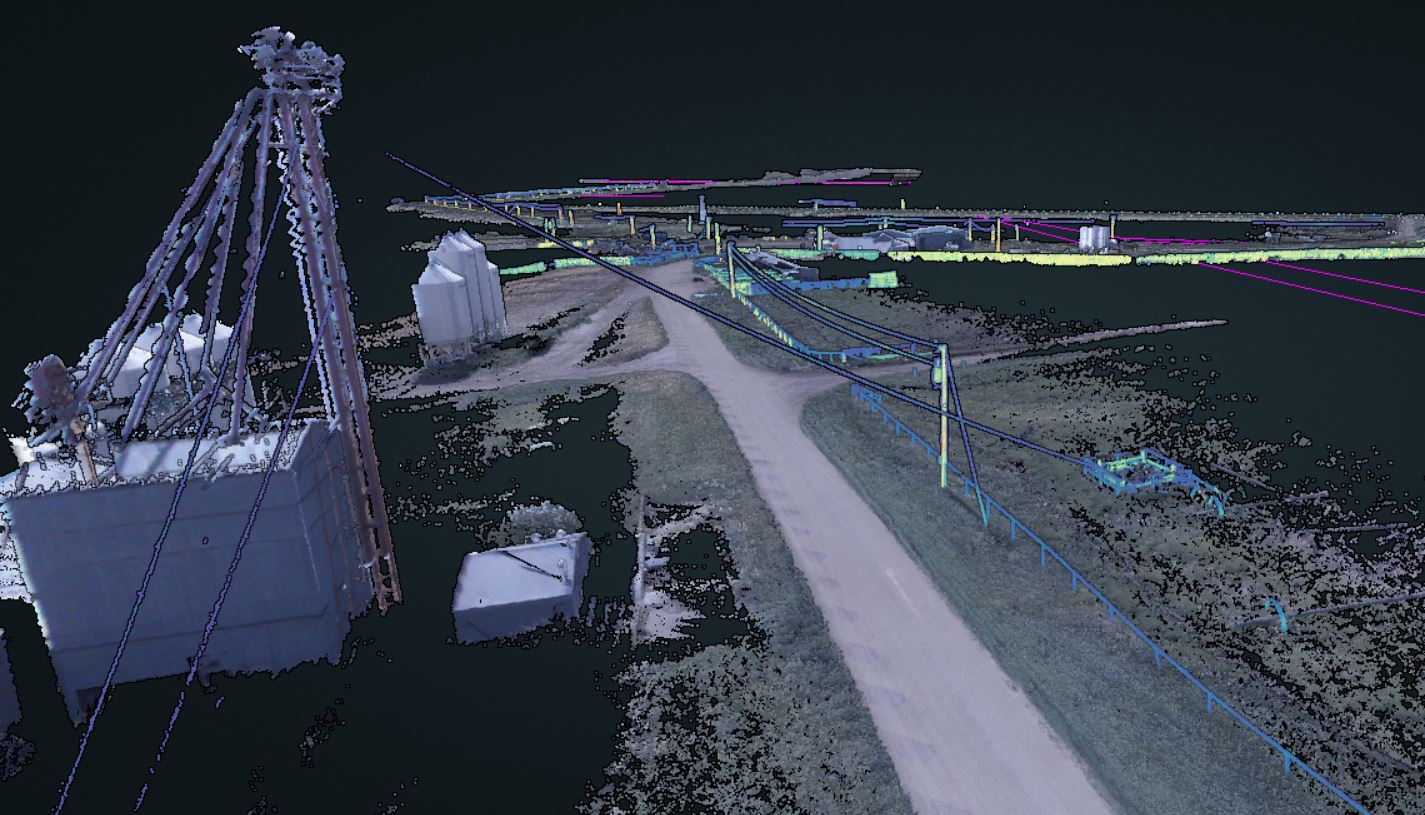
Larson Livestock Utility Asset Mapping and Surface Modelling
Client: ATCO Electric.
Contract Date: July, 2020
Distance: 16km
The remote location and varied terrain provided the ideal scenario for mobile LiDAR scanning. As such, Nektar 3D was contracted to provide Mobile LiDAR scans along the 16-kilometer corridor for surface modelling and utility mapping purposes. After collecting and processing LiDAR scans, the following was carried out.
- Digital Elevation Model Generation
- AI-Based Point Cloud Classification
- Detailed Asset Extraction (Poles, Powerlines, Fence lines ….etc).
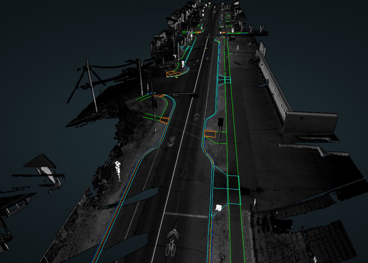
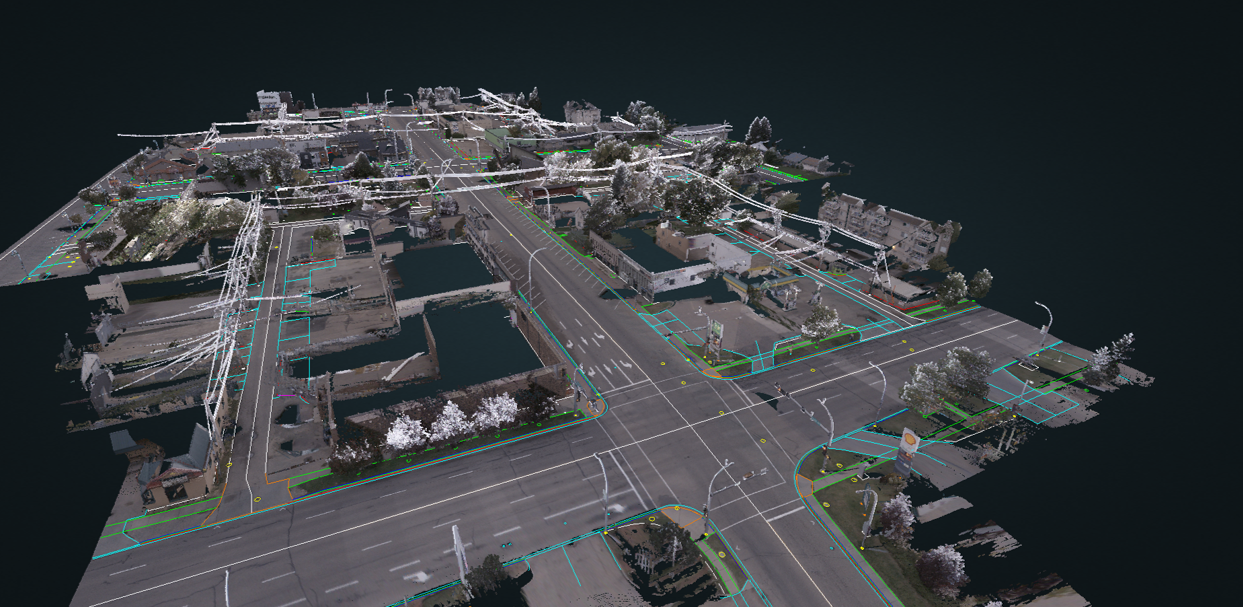
Urban Subdivision Concept Planning and Design
Client: Al-Terra Engineering Ltd.
Contract Date: Sept, 2019
Distance: 14.5km
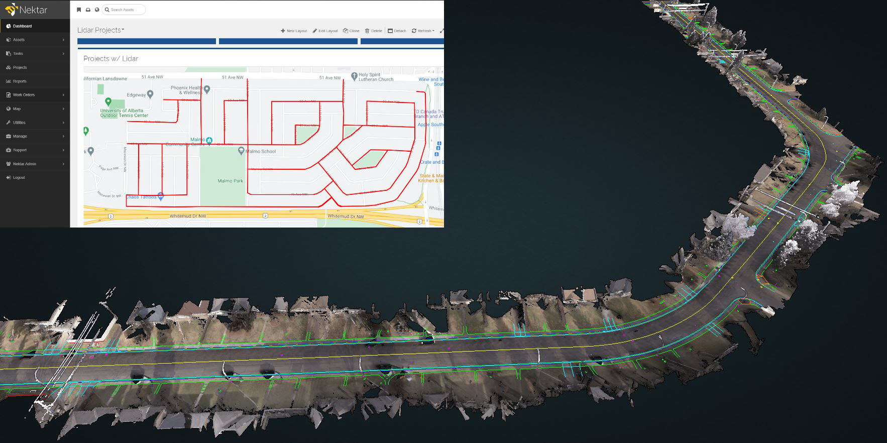
Nektar 3D was contracted to survey a subdivision in South-Central Edmonton for concept planning and preliminary design purposes. Mobile LiDAR was used to create a detailed model of the existing conditions including roadways, sidewalks, and surrounding buildings. The LiDAR scans were used to generate a full 3D CAD record of existing conditions including details of curb lines, sidewalk lines, poles, signs, and other features.
Spruce Grove City Center Area Redevelopment Plan (CCARP)
Client: ISL Engineering and Land Services.
Contract Date: Aug, 2020
Distance: 2km
This project involved generating a CAD record of the City Center area in the City of Spruce Grove to be used for detailed design. A total station controlled mobile LiDAR scan of existing conditions was first conducted using Nektar 3D’s laser scanner. The LiDAR scans were then used to generate a full CAD record of existing conditions including details of curb lines, sidewalk lines, poles, signs, and other features.
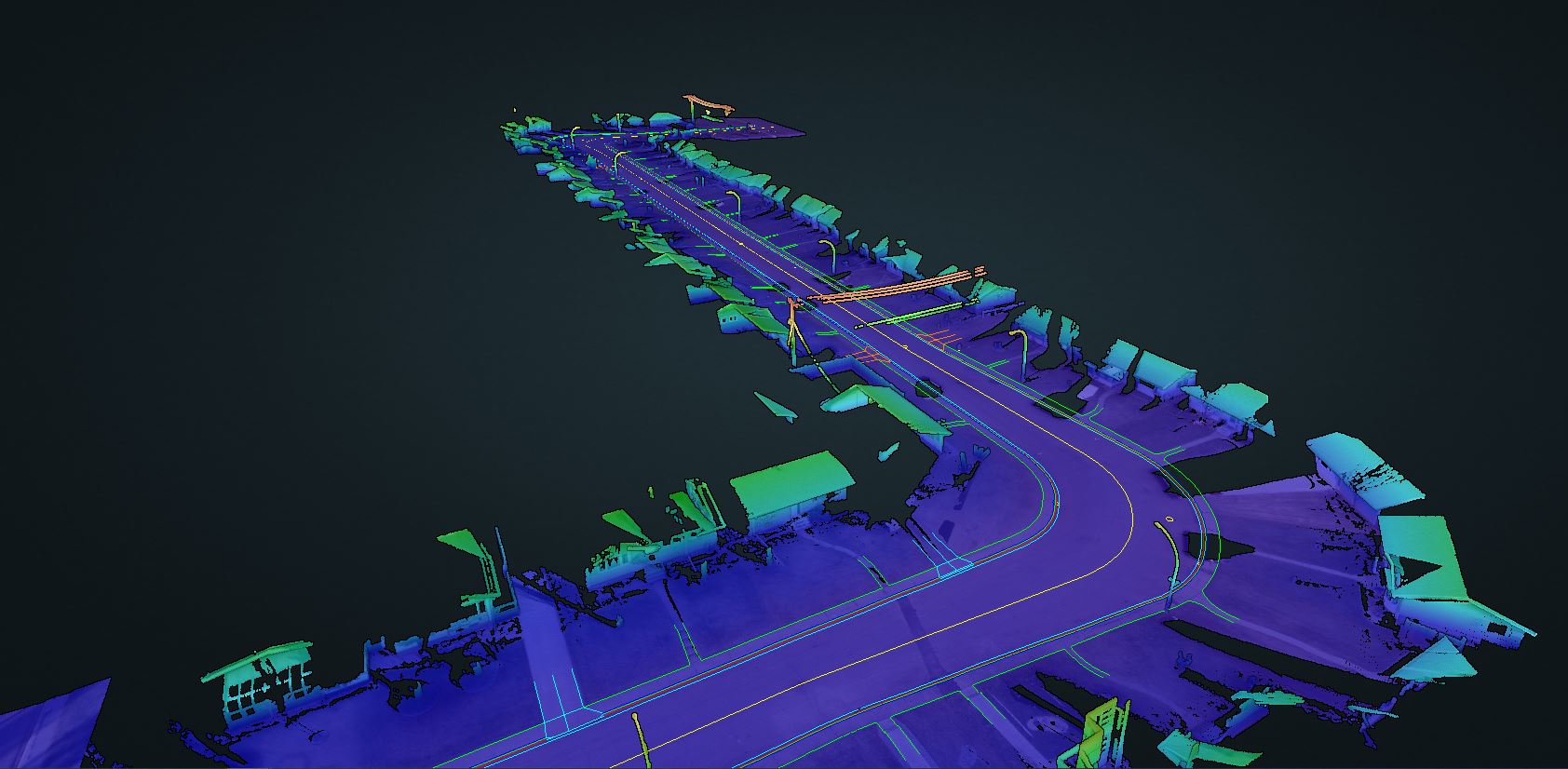
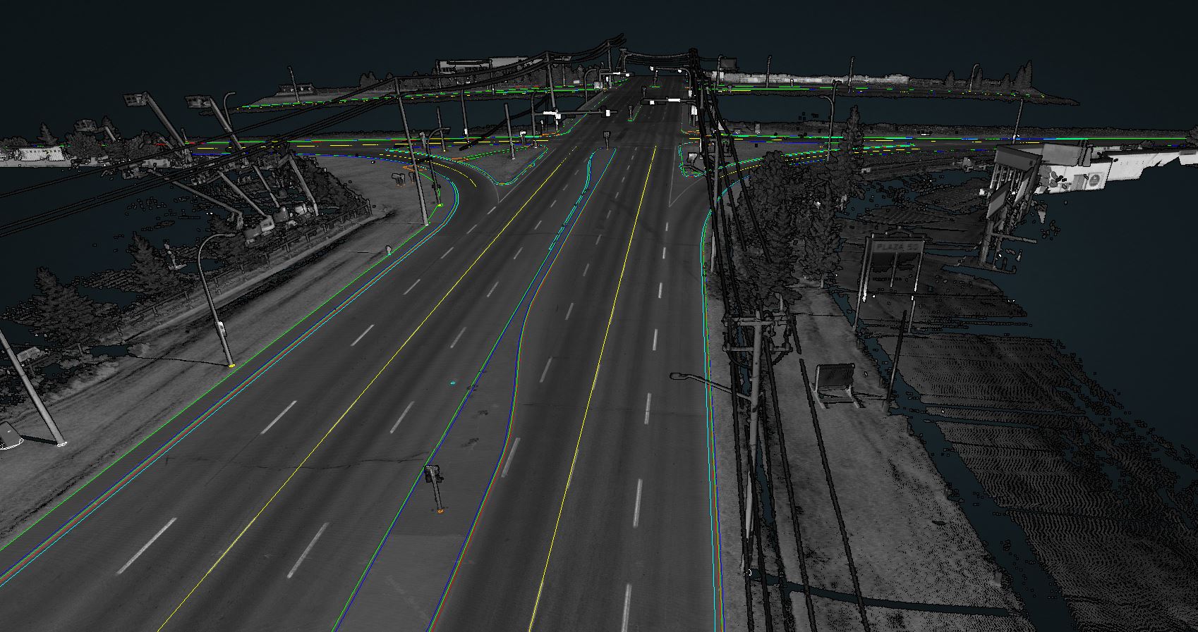
Township 510 Functional Planning Study
Client: ISL Engineering and Land Services.
Contract Date: Aug, 2020
Distance: 6 km
This project involved efficiently collecting and classifying a mobile LiDAR scan of the Township 510 highway north of the City of Beaumont. The scan was processed and Nektar 3D’s AI algorithms were used to classify the data into multiple features including (vegetation, ground, culverts, traffic signs, poles, fence lines…etc). All features were also produced in CAD compatible drawings. This information was used to support a functional planning study investigating the potential for grade widening along the road.
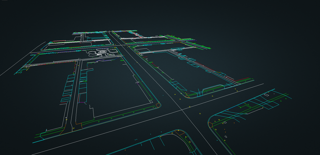
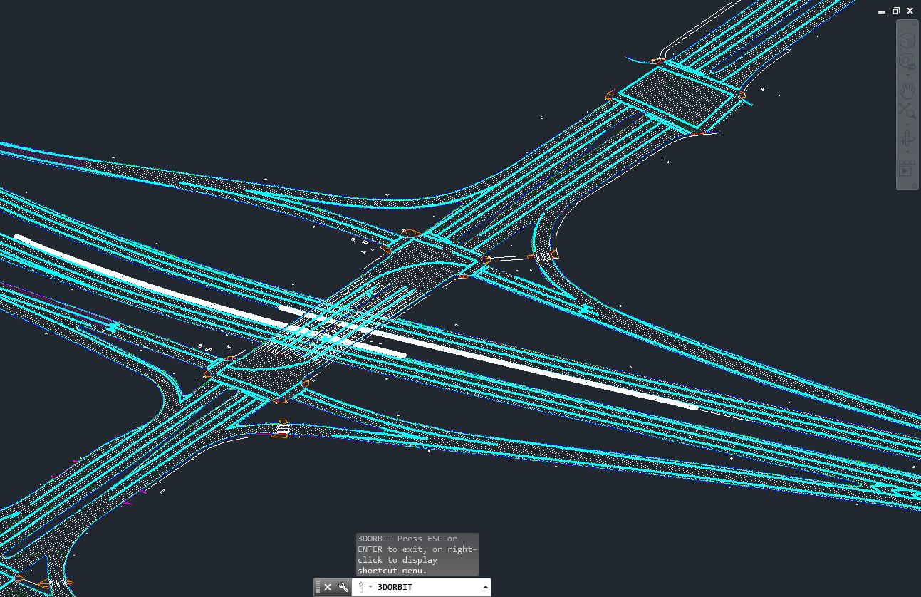
50th Street Grade Widening and CPR Interchange
Client: ISL Engineering and Land Services, AECOM Ltd, Alberco Construction Ltd, and the City of Edmonton
Contract Date: Oct, 2020
Distance: 10km
Nektar 3D used mobile LiDAR to support multiple stages of the 50th Street Grade Widening CPR Interchange project (concept planning and design). This involved conducting multiple scans of the 50th street corridor near the Canadian Pacific Rail (CPR) crossing and the Sherwood Park Freeway interchange including all side streets. The data was registered and classified and then used to produce a CAD record of the area to support planning and design activities.

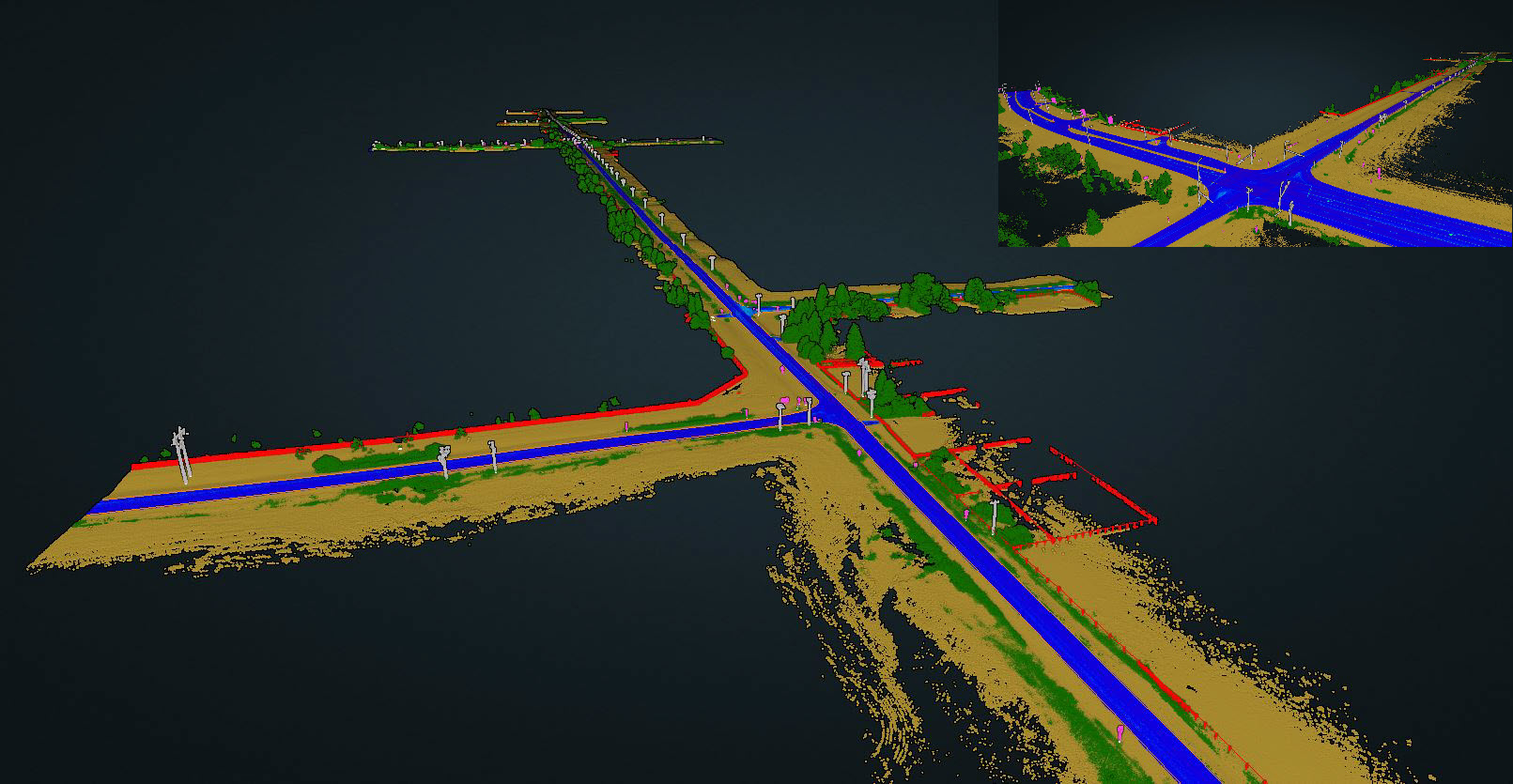
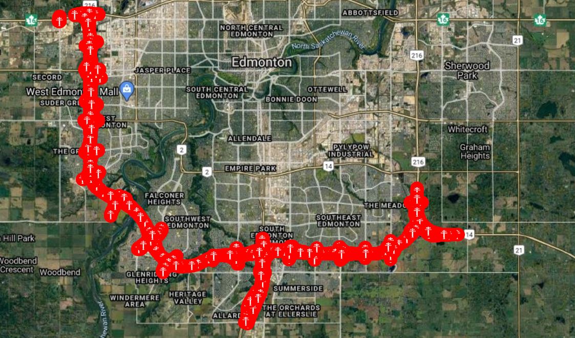
Edmonton Valley Line West LRT Expansion Project
Client: Marigold Infrastructure Partners and the City of Edmonton.
Contract Date: Nov, 2020 – Present
Distance: 28km
On this project, Nektar 3D was contracted to conduct a highly detailed LiDAR scan of the project corridor in support of several different project activities (planning, design, tree survey, site documentation). After completing the field data collection, the scans were tied down using total station control data. The data was then classified using Nektar 3D’s AI algorithms and used to conduct a virtual tree survey. The LiDAR scans were also used to locate boreholes and other roadside assets. Besides that, the scan data was also used to produce a full topographical survey of existing conditions in CAD compatible format to be used to support design activities. The Marigold Infrastructure Partners project team consists of Colas, Parsons, Standard General, Francl Architecture, Fast & Epp and Stantec.
Garneau Neighbourhood Renewal
Client: Al-Terra Engineering Ltd.
Contract Date: May, 2019
Distance: 7.9km
Nektar 3D was contracted to carry out a mobile LiDAR survey Edmonton’s Garneau neighbourhood for preliminary design. Truck-mounted LiDAR was used to provide detailed scans of roadway and sidewalk conditions. The LiDAR scans were used to generate a full CAD record of existing conditions including details of curb lines, sidewalk lines, poles, signs, and other features.
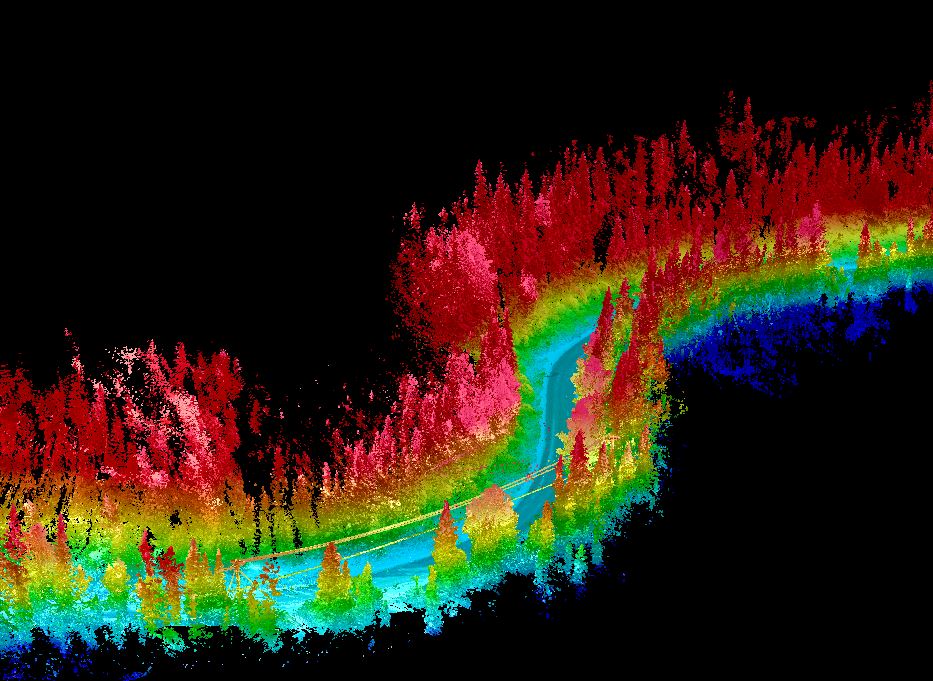
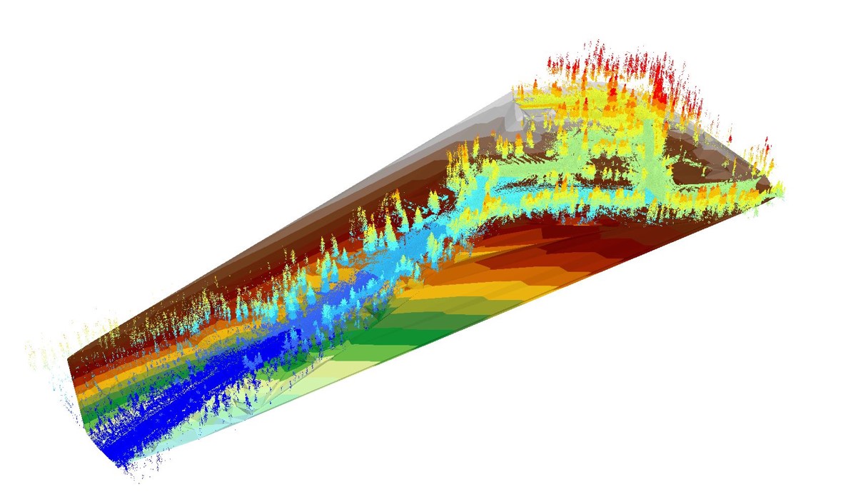
River Valley Alliance Trail System
Client: River Valley Alliance
Contract Date: Nov, 2018
Distance: 10km
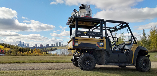
Nektar 3D was contracted to provide UTV-mounted mobile LiDAR to survey a short segment of trails managed by the River Valley Alliance. Mobile LiDAR scans were utilized for asset extraction and to assess trail topography.
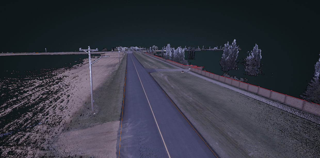
Erin Ridge Drive Traffic Calming
Client: Wilco Contractors Northwest Inc.
Contract Date: July, 2018
Distance: N/A
Truck-mounted mobile LiDAR was contracted to survey existing conditions. The highly detailed LiDAR scans provided the existing ground surface and asset locations, invaluable for the design of high visibility cross walks for traffic calming purposes.
Urban Subdivision Concept Planning and Design
Client: ISL Engineering and Land Service Ltd.
Contract Date: Oct, 2019
Distance: 7.8km
Nektar3D create a full digital model of an urban subdivision near Southgate Mall in Edmonton, AB for concept planning and preliminary design purposes. Mobile LiDAR was used to collect detailed scans of the subdivision and the scan data was then used to create a 3D CAD record of all infrastructure details including curb lines, sidewalks, poles, trees, driveways …etc.
.
Edmonton Valley Line Southeast LRT Expansion (Quantity Estimates)
Client: Wilco Contractors Northwest Inc.
Contract Date: Nov, 2018
Distance: N/A
UTV-mounted mobile LiDAR was contracted to survey the Valley Line LRT under construction for the survey of soil bed quantities.
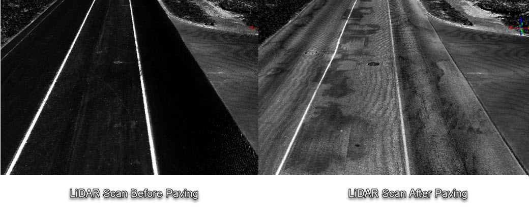
Pavement Surface CCC
Client: Lafarge Canada Inc.
Contract Date: Aug, 2018
Distance: N/A
Nektar3D was contracted to survey a resurfaced portion of Allard Way in Edmonton, Alberta. Truck-mounted mobile LiDAR was used to compare settlement at CCC to FAC conditions, simplifying the critical construction step which requires a high-level of accuracy.
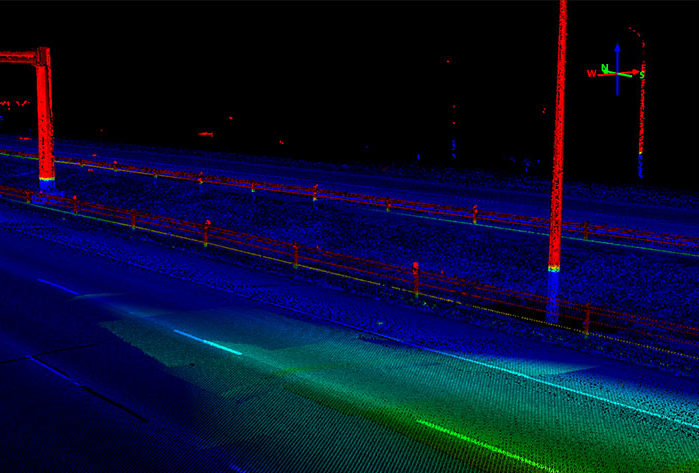
Anthony Henday Fixed Asset Identification
Client: Lafarge Canada Inc.
Contract Date: June-Oct, 2018
Distance: 42km
Nektar 3D was contracted to survey the Southwest portion of the Anthony Henday Drive in Edmonton, Alberta. These truck-mounted mobile LiDAR scans were utilized to light poles and High Tension Cable Barriers on the scanned portion of the highway.
Highway 15 Construction Quantity Measurement
Client: Alberco Construction Ltd.
Contract Date: August, 2020
Distance: N/A
A time-critical assessment of existing earth stockpiles was required to provide quantities for pay items. Nektar 3D captured a photogrammetric scan to provide a quick survey of the existing stockpiles. We deployed our drone to collect the scan, which was then used to measure quantities. The scan was completed just in time prior to earthworks began.
Grandin Barrier Wall (St. Albert)
Client: Wilco Contractors Northwest Inc.
Contract Date: April, 2019
Distance: N/A
Truck-mounted mobile LiDAR was contracted to survey the noise barrier wall along St. Albert Trail bordering the Grandin neighbourhood. This was used to determine the location of the wall alongside the roadway and quantifies existing conditions along the wall and its surrounding area. Scans from the pre-construction and post construction stage were registered for documentation of site conditions.
Miette Road Asset Identification and Surface Assessment
Client: ATCO Electric Ltd.
Contract Date: Oct, 2019
Distance: N/A
To aide planning efforts for new electrical infrastructure along Miette Road’s delicate and difficult roadside environment, Nektar3 D was contracted to provide an efficient mobile LiDAR scan of the 9.8-kilometer corridor prior to the snow fall. The project also involved using the LiDAR scans to generate accurate Digital Elevation models of the corridor.
ATCO Larson Livestock Asset Identification and Surface Assessment
Client: ATCO Electric Ltd.
Contract Date: July, 2020
Distance: 16km
The remote location and varied terrain provided the ideal scenario for mobile LiDAR scanning. As such, Nektar 3D was contracted to provide Mobile LiDAR scans along the 16-kilometer corridor for surface modelling and utility mapping purposes. After collecting and processing LiDAR scans, the following was carried out.
- Digital Elevation Model Generation
- AI-Based Point Cloud Classification
- Detailed Asset Extraction (Poles, Powerlines, Fence lines ….etc).
Urban Subdivision Concept Planning and Design
Client:Al-Terra Engineering Ltd.
Contract Date: Sept, 2019
Distance: N/A
Nektar 3D was contracted to survey a subdivision in South-Central Edmonton for concept planning and preliminary design purposes. Mobile LiDAR was used to create a detailed model of the existing conditions including roadways, sidewalks, and surrounding buildings. The LiDAR scans were used to generate a full 3D CAD record of existing conditions including details of curb lines, sidewalk lines, poles, signs, and other features.
ATCO Larson Livestock Asset Identification and Surface Assessment
Client: ATCO Electric Ltd.
Contract Date: July, 2020
Distance: 16km
The remote location and varied terrain provided the ideal scenario for mobile LiDAR scanning. As such, Nektar 3D was contracted to provide Mobile LiDAR scans along the 16-kilometer corridor for surface modelling and utility mapping purposes. After collecting and processing LiDAR scans, the following was carried out.
- Digital Elevation Model Generation
- AI-Based Point Cloud Classification
- Detailed Asset Extraction (Poles, Powerlines, Fence lines ….etc).
Miette Road Asset Identification and Surface Assessment
Client: ATCO Electric Ltd.
Contract Date: Oct, 2019
Distance: N/A
To aide planning efforts for new electrical infrastructure along Miette Road’s delicate and difficult roadside environment, Nektar3 D was contracted to provide an efficient mobile LiDAR scan of the 9.8-kilometer corridor prior to the snow fall. The project also involved using the LiDAR scans to generate accurate Digital Elevation models of the corridor.
ATCO Larson Livestock Asset Identification and Surface Assessment
Client: ATCO Electric Ltd.
Contract Date: July, 2020
Distance: 16km
The remote location and varied terrain provided the ideal scenario for mobile LiDAR scanning. As such, Nektar 3D was contracted to provide Mobile LiDAR scans along the 16-kilometer corridor for surface modelling and utility mapping purposes. After collecting and processing LiDAR scans, the following was carried out.
- Digital Elevation Model Generation
- AI-Based Point Cloud Classification
- Detailed Asset Extraction (Poles, Powerlines, Fence lines ….etc).
Miette Road Asset Identification and Surface Assessment
Client: ATCO Electric Ltd.
Contract Date: Oct, 2019
Distance: N/A
To aide planning efforts for new electrical infrastructure along Miette Road’s delicate and difficult roadside environment, Nektar3 D was contracted to provide an efficient mobile LiDAR scan of the 9.8-kilometer corridor prior to the snow fall. The project also involved using the LiDAR scans to generate accurate Digital Elevation models of the corridor.
ATCO Larson Livestock Asset Identification and Surface Assessment
Client: ATCO Electric Ltd.
Contract Date: July, 2020
Distance: 16km
The remote location and varied terrain provided the ideal scenario for mobile LiDAR scanning. As such, Nektar 3D was contracted to provide Mobile LiDAR scans along the 16-kilometer corridor for surface modelling and utility mapping purposes. After collecting and processing LiDAR scans, the following was carried out.
- Digital Elevation Model Generation
- AI-Based Point Cloud Classification
- Detailed Asset Extraction (Poles, Powerlines, Fence lines ….etc).