LiDAR Use Cases in Transportation
How LiDAR-based engineering consulting impacts your everyday projects.
sxasxasxs
Mobile LiDAR datasets could be used across a range of applications within a transportation agency. At Nektar 3D Consulting our aim is to ensure that your LiDAR scans are fully utilized across different departments, for different projects, and during different stages of a project.
Transportation Engineering & Highway Design
The high precision and accuracy of mobile LiDAR datasets combined with Nektar 3D Consulting’s efficient feature extraction capabilities ensure that the datasets can be used for a range of different applications in the field of Transportation Engineering and Highway Design. This includes the following and much more.
Functional Planning Studies
Topographical Surveys
Routine Geometric Assessments
Road Safety Audits
Traffic Impact Assessments
Routine Bridge Inspections
Slope Stability Assessments
Clearance Assessment for Overheight Permits
Resurfacing, Restoration, and/or Rehabilitation (3R) Projects
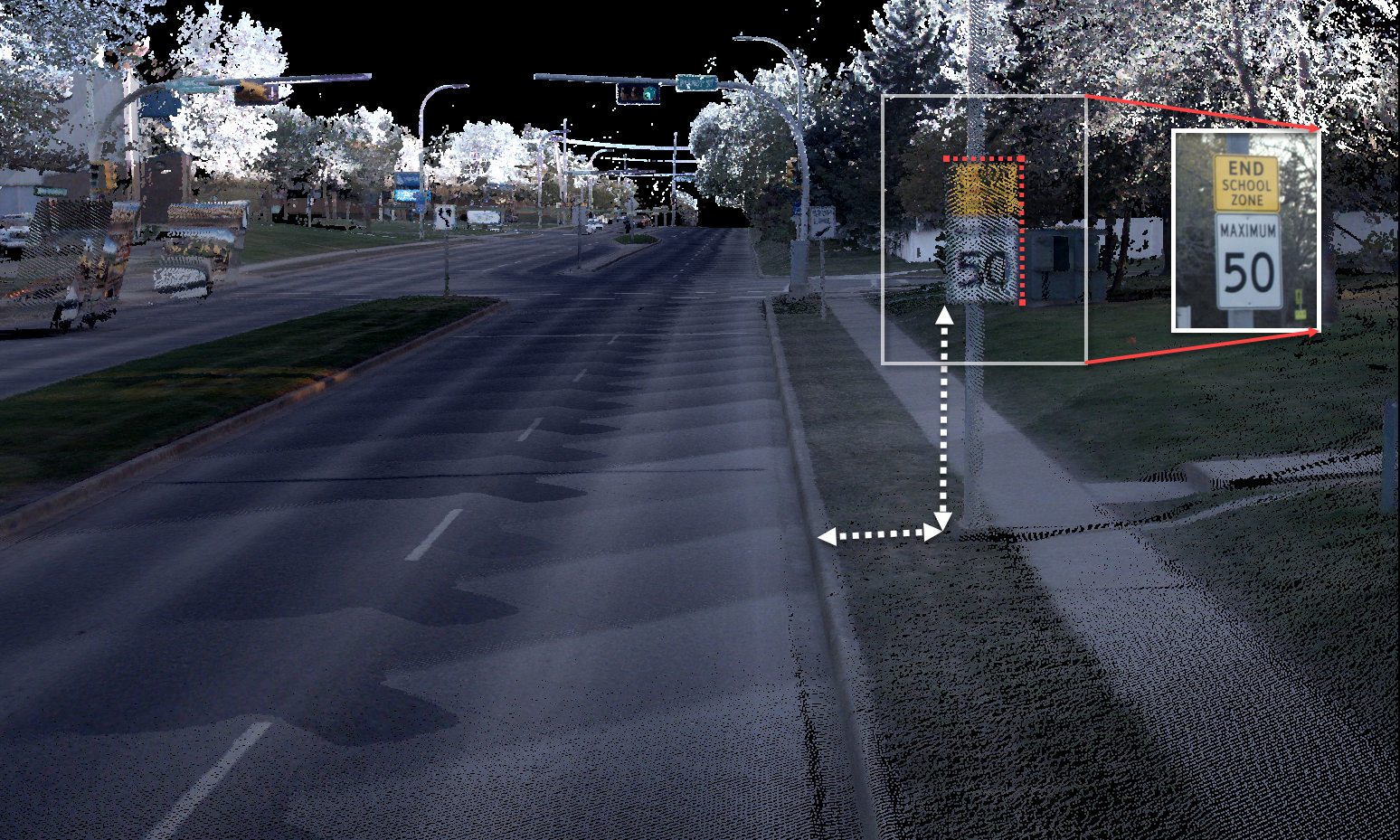
Road Safety Signing Audits
Asset Inventory and Management
Nektar 3D Consulting’s Network-Level extraction capabilities can also be utilized by Departments of Transport (DOT) interested in using their LiDAR datasets for asset management purposes such as
1. Transportation Asset Management (TAM)
Statewide feature extraction of assets from LiDAR using Nektar 3D Consulting’s services helps DOTs adopt a sustainable asset stewardship program, effectively utilising their resources and funding. Not only does that provide a comprehensive dataset which maps vital infrastructure elements, but it is a sustainable solution which can be used to monitor assets throughout the service life of a highway.
2. Model Inventory of Roadway Elements (MIRE)
Statewide feature extraction of assets from LiDAR using Nektar3D Consulting’s services helps DOTs adopt a sustainable asset stewardship program, effectively utilizing their resources and funding. Not only does that provide a comprehensive dataset which maps vital infrastructure elements, but it is a sustainable solution which can be used to monitor assets throughout the service life of a highway.
MIRE was introduced as a platform to make data-driven roadway safety decisions. The transportation environment is described by six core elements, including:
Segment
Intersection
Intersection Leg
Interchange/Ramp
Horizontal Curve
Vertical Grade
Similar to the application of LiDAR for TAM, efficient extraction of features from mobile LiDAR scans allows for the collection of several attributes for those roadway elements including:
Roadside fixed objects
Signs
Bridge Descriptors
Railroad grade-crossing descriptors
This helps agencies overcome the burden associated with long site visits when creating their MIRE database.