Successful Utilization of AI and LEICA Lidar Scanning Technology
Using Leica Pegasus Technology and AI on the City of Edmonton’s Valley Line West LRT Expansion Project being constructed by
MARIGOLD INFRASTRUCTURE PARTNERS (Parson’s / Colas JV)
![]()

sxasxasxs
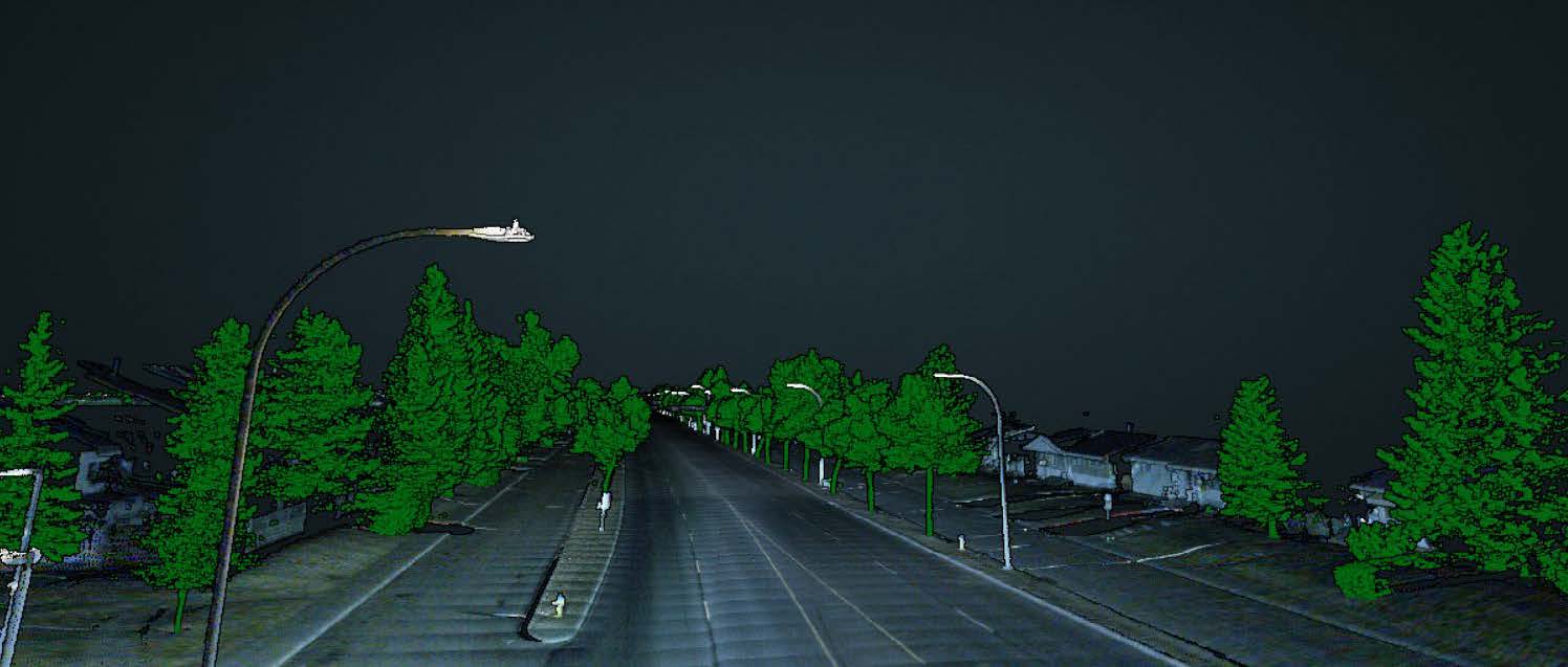
The high accuracy of mobile Light Detection and Ranging (LiDAR) datasets collected using Leica’s Pegasus Scanning Systems and the ability to extract information from the datasets without the need for regular site visits and traffic control makes them an asset to any transportation project.
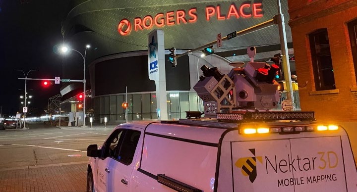
On the $2.61bn Edmonton Valley Line West LRT (Light Rail Transit) Expansion project, Nektar 3D demonstrated means through which the role of the technology can go from being a mere replacement of traditional survey to a virtual incubator of multiple project activities on such a mega project.
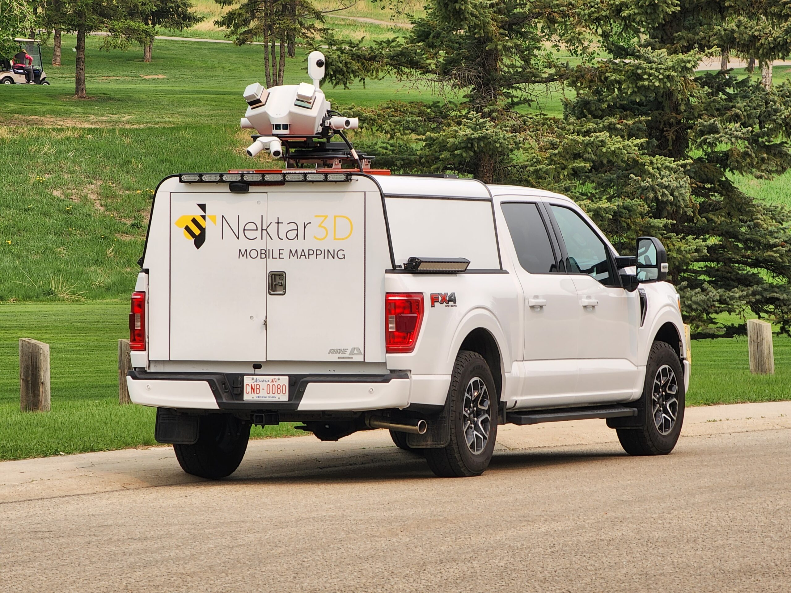
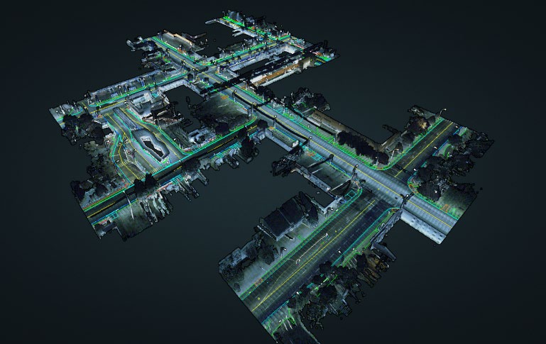
The LiDAR scans used in this project were collected using Leica Pegasus Two Ultimate laser scanning system. The system owned by Nektar 3D system is equipped with two high-end Z+F 9012 laser scanners that have combined a scan rate of up to 2,000,000 points per second. This provides a tremendously detailed point cloud that captures the finest details of the surrounding infrastructure including curb dimensions, grades, and cross-sectional slopes.
With an extremely powerful Global Navigation Satellite System (GNSS) and an Inertial Measurement Unit (IMU), the system is capable of achieving an absolute positional accuracy of 0.020m (horizontal) and 0.015m (vertical) in open skies based on testing conducted by the manufacturer. The relative accuracy (i.e. the accuracy of measurements within the scan) is typically within the 1-millimeter range. The scanning system can achieve a point density of up to 1500ppm2 on the road surface and a survey-grade horizontal and vertical accuracy in highway open space.
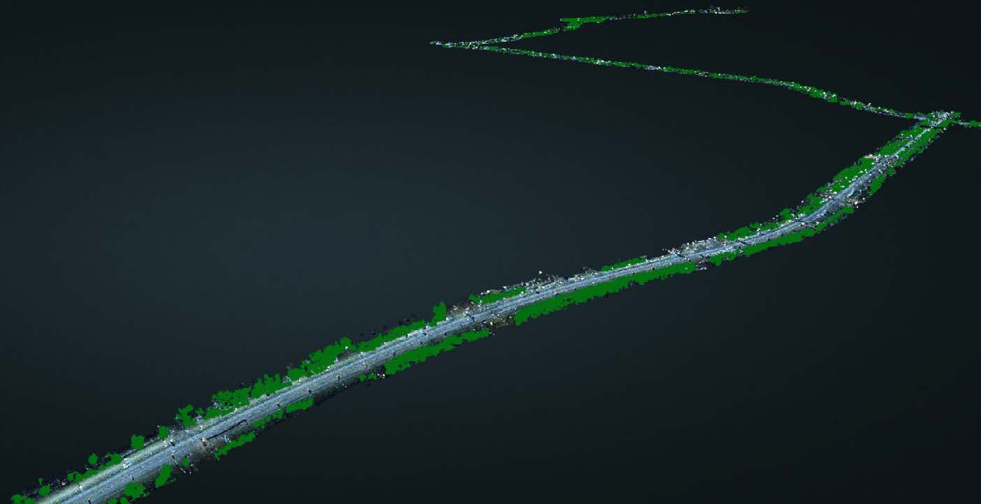
Thanks to the high accuracy of the data, the efficiency of the Leica System in capturing data, and full collaboration from project partners, mobile LiDAR scans of the proposed 28km route were collected in a very short survey window overcoming challenging weather conditions.
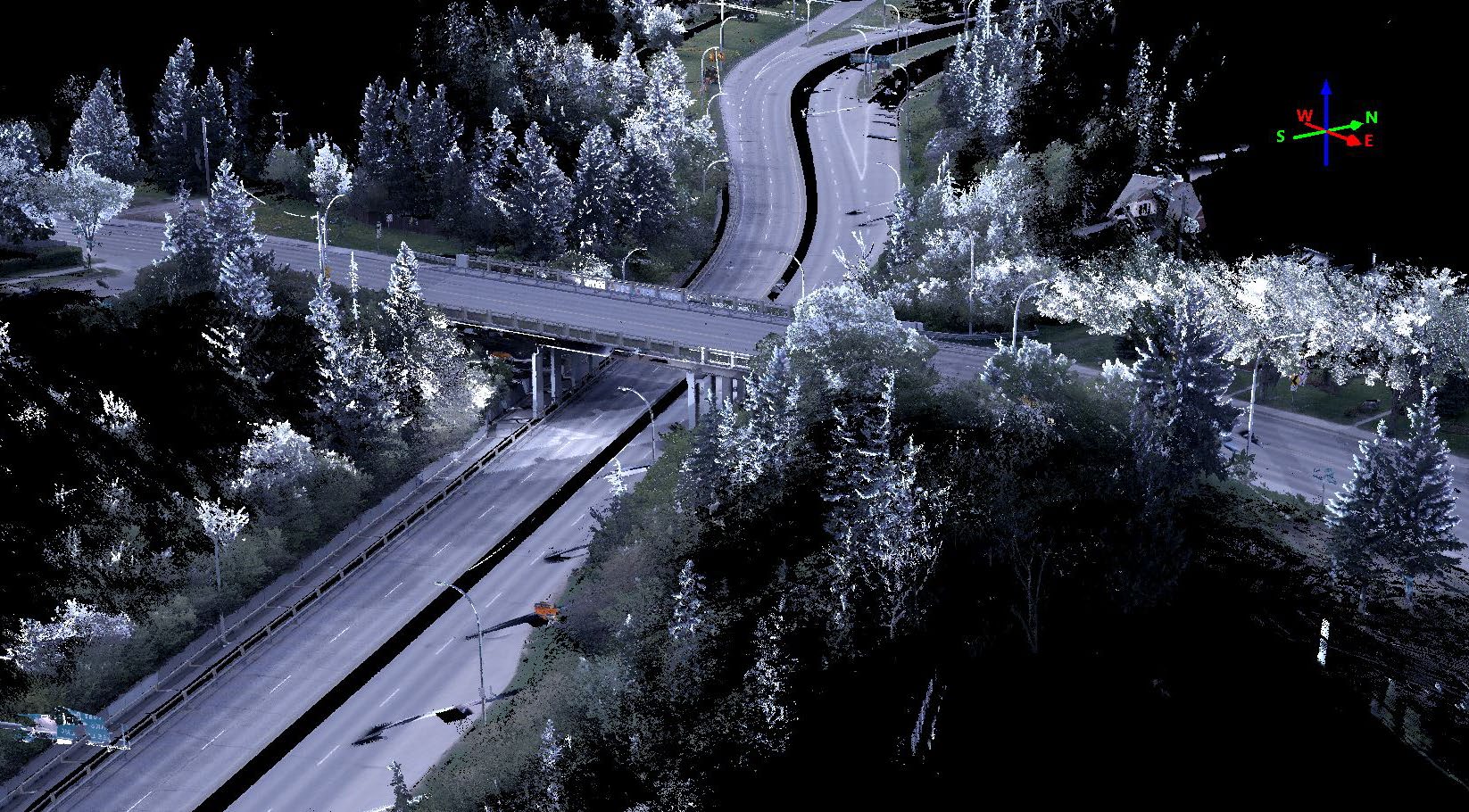
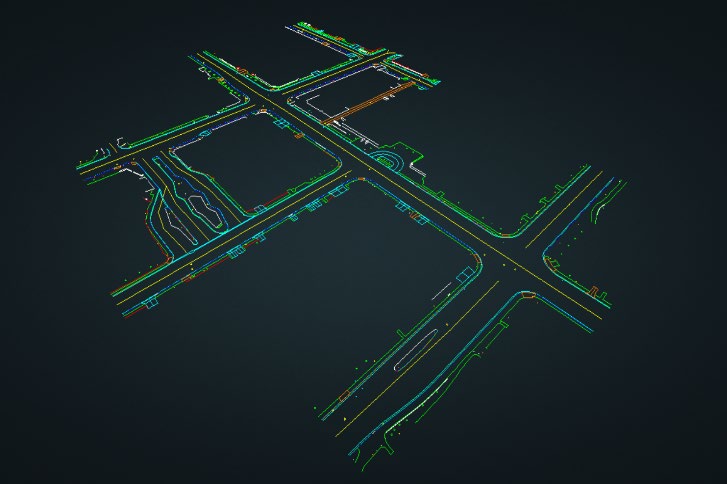
After completing the field data collection, the data was geospatial registered using Leica’s Pegasus Manager Software. Nektar 3D’s proprietary deep learning algorithms were then employed to automatically clean the data and segment it into multiple features. The data was then used to create highly detailed 3D CAD as built of existing features including curb lines, sidewalks, over-ground utilities, and roadside furniture.
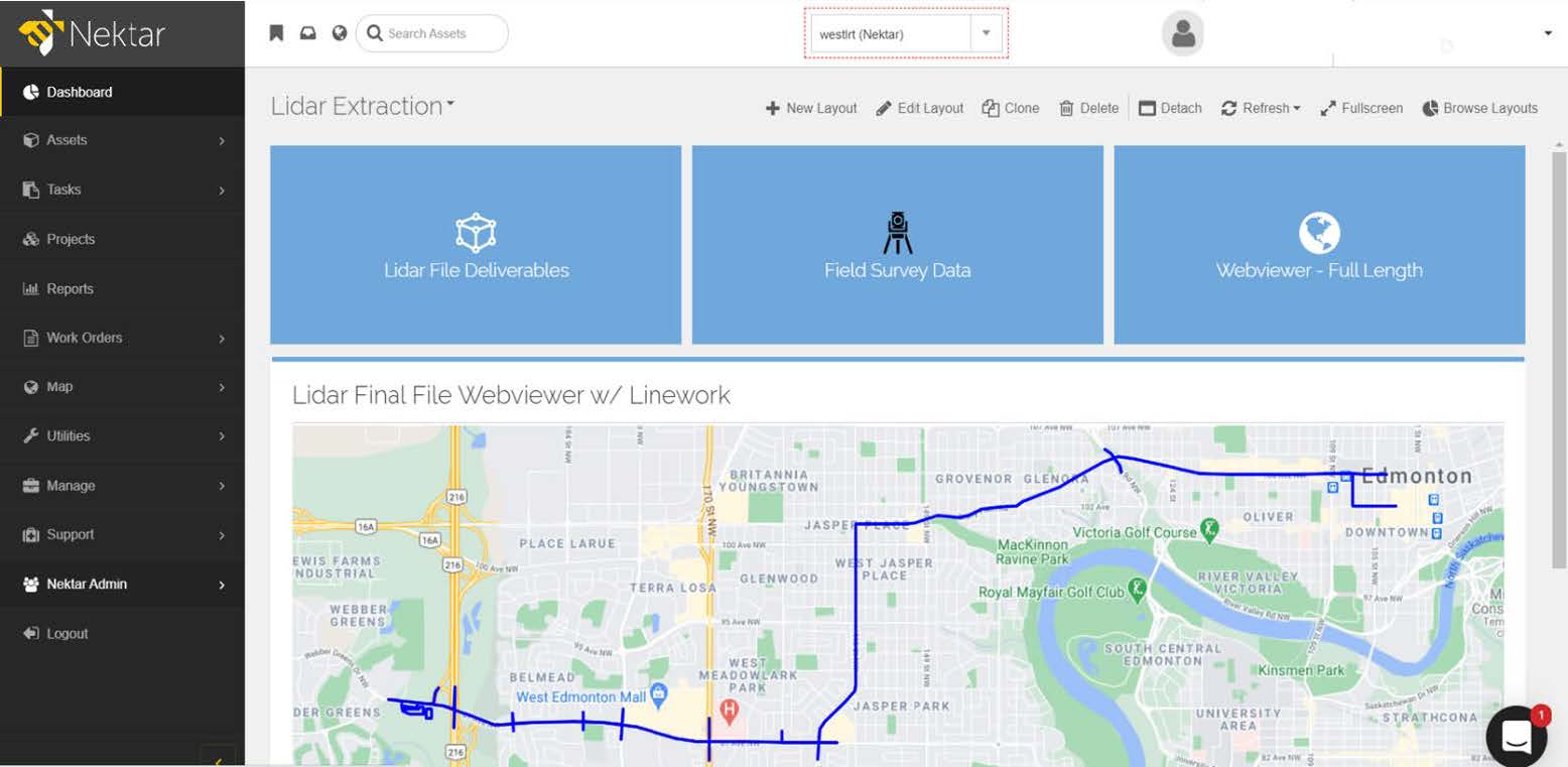
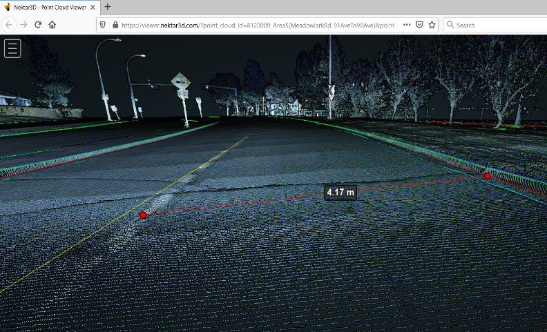
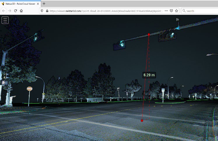
To facilitate virtual site visits, the LiDAR scan was then tied to 2D map in Nektar’s cloud-based GIS platform. This provided the project team with access to a 3D model of any region of the project through the click of a mouse in the Nektar Platform.
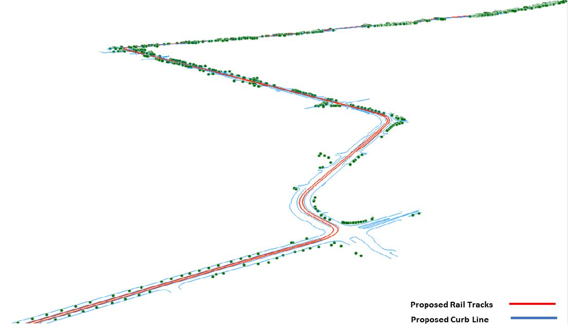
Data was also used to identify conflicts between the proposed rail line and existing trees. Vegetation points were first filtered from the remainder of the LiDAR classes. A fully automated algorithm was then developed to estimate the offset of existing trees from the proposed design, with the aims of identifying trees that must be relocated in order to accommodate the proposed design. The LiDAR data was also used to map borehole locations and identify conflicts and potential obstructions.
Nektar 3D was awarded the contract by Marigold in late October and within 2 days mobilized to site and captured the entire corridor in the following 2 weeks. Leveraging the use of Mobile Lidar in the format in which Nektar and Leica presented to the Marigold Parson’s team, saved several months in design time when compared to conventional survey methods.
The success of Valley Line West LRT in Edmonton Alberta, as well as several other infrastructure projects, has solidly anchored Nektar3D as the premier go to for Lidar, AI and pre design services provider in Western Canada.
With this positioning Nektar3D has recently invested in the first Leica Pegasus TRK NEO 700 scanning system in Canada. In addition to all the qualities of its predecessor, the TRK 700 enhances Nektar 3D’s capabilities on future projects by providing:
- Higher accuracy and georeferencing in environments with limited GNSS (Global Navigation Satellite System) coverage as a result of the advanced integration of IMU and SLAM technology in the sensor architecture.
- Precision RTK positioning providing centimeter-level location accuracy in real-time.
- High absolute accuracy without additional ground control points.
- Wider scan range resulting in more data captured in less survey passes.
- A SmartFusion ‘butterfly’ camera system with up to 120MP integral view. Boosted with add-on front, side and rear pavement cameras, the additional cameras multiply the resolution, creating data-rich imagery.
- AI-based automated blurring of personal information including license plates and faces.
- Improved calibration resulting in true colour imagery according to the CIEDE2000 colour-difference formula
- Streamlined and user-friendly data processing with the Cyclone Pegasus Office.
Nektar 3D and Leica will continue to provide exciting world class scanning, HD mapping, infrastructure digital twins and AI classification services to our clients across Canada for years to come.