Data Processing Using Artificial Intelligence
At Nektar 3D Consulting we employ Artifical Intelligence to effciently process your point cloud data
Collecting more data than you can process?
Our consulting team utilizes artificial intelligence (AI) to help you extract high quality features from your LiDAR datasets in a highly efficient manner.
Independent of location, scanner, or collection method, our AI algorithms can help you efficiently classify and clean your point cloud data in a fully automated unattended manner.
Extend the capabilities of your LiDAR team with accurate classified data.
Accurate
Refine AI systems which accurately classify your LiDAR data at scale
Adaptable
Whether ground-based or aerial, rural or urban, our system adapts to your environment to deliver classified data with best-in-class accuracy
Regular Updates
We partner to gain access to datasets from around the world, getting up-to-date scans with high quality annotations to keep our system ready for changing environments
How it works
Our basemodels are trained to recognize multiple types of objects at varying levels of accuracy.
See the list below for examples of objects that the models have been trained to classify.
Our Model’s Capabilities
Natural
Ground
Low/Medium/High Vegetation
Ground Elements
Road Surface
Sidewalks
Ramps
Lane Markings
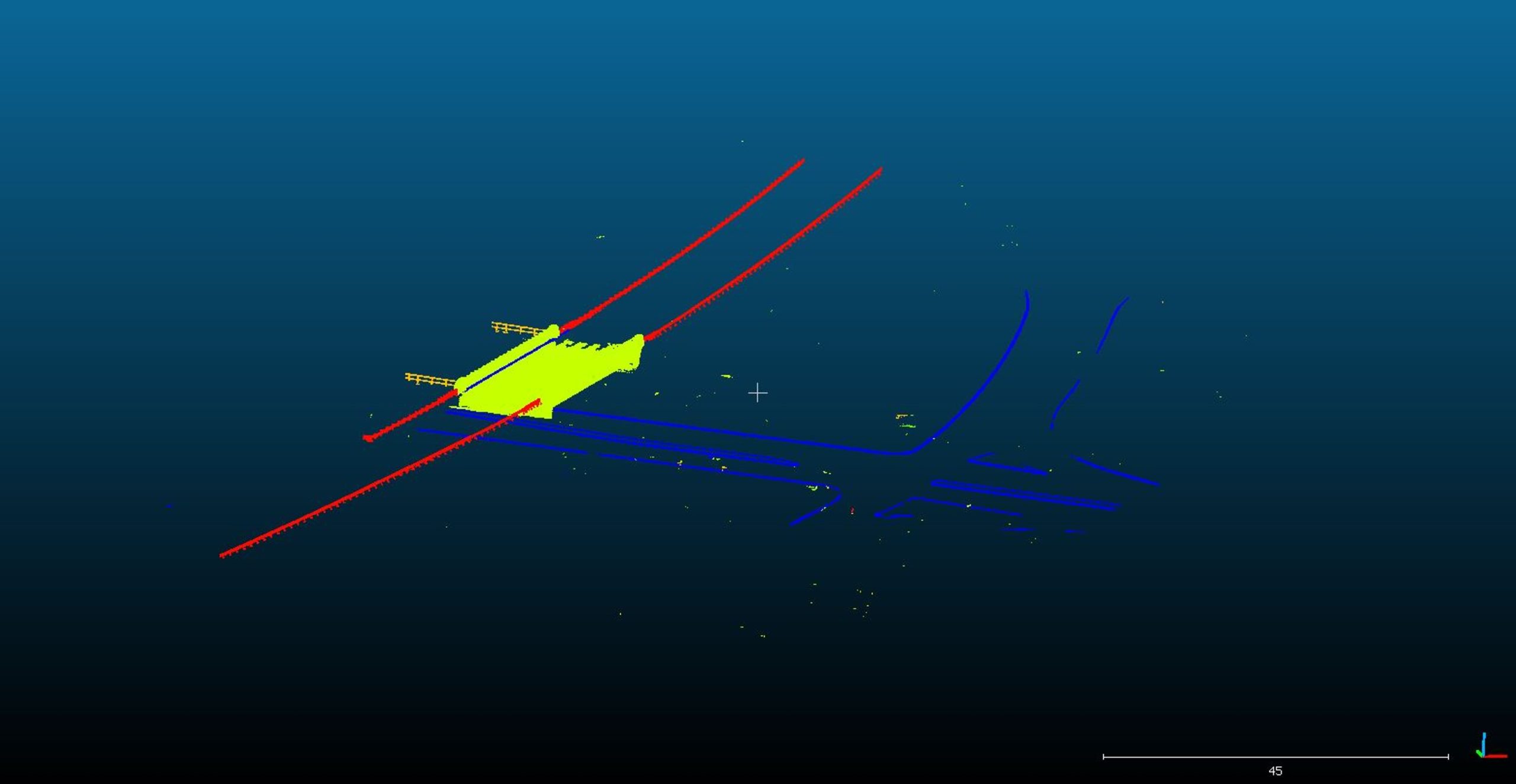
Guardrails
Off Ground
Traffic Signs
Poles
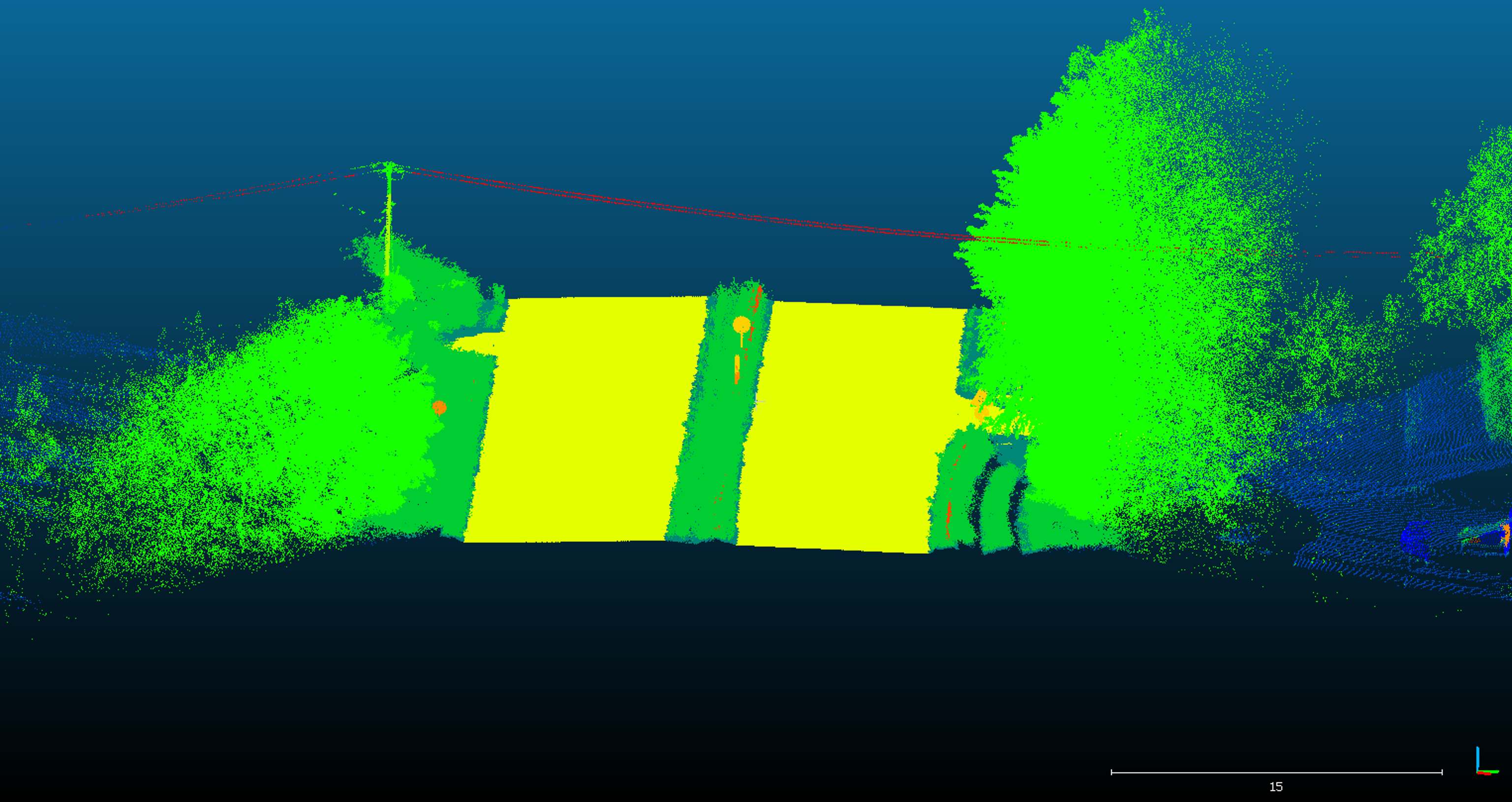
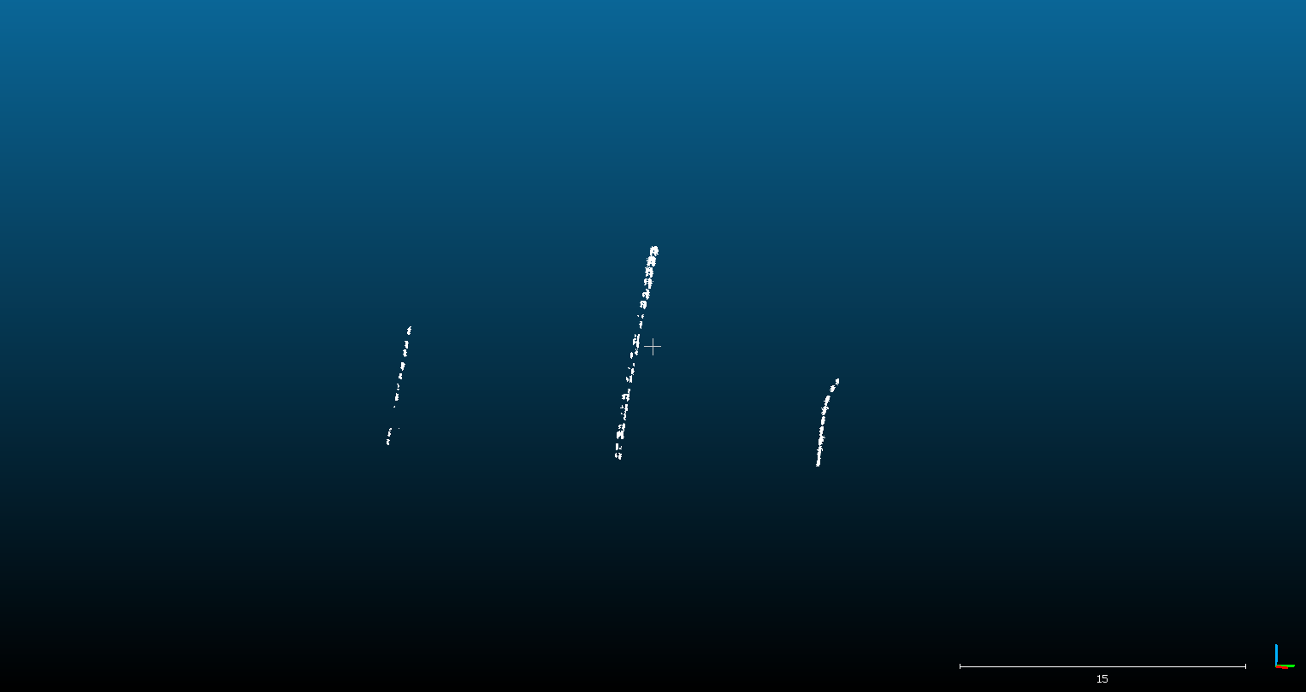
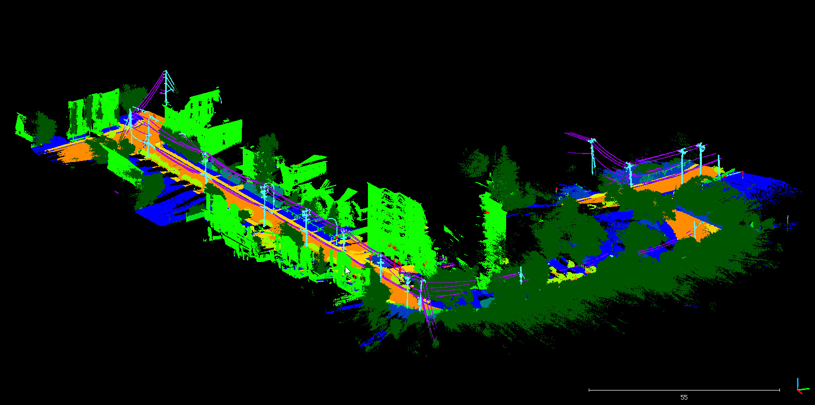
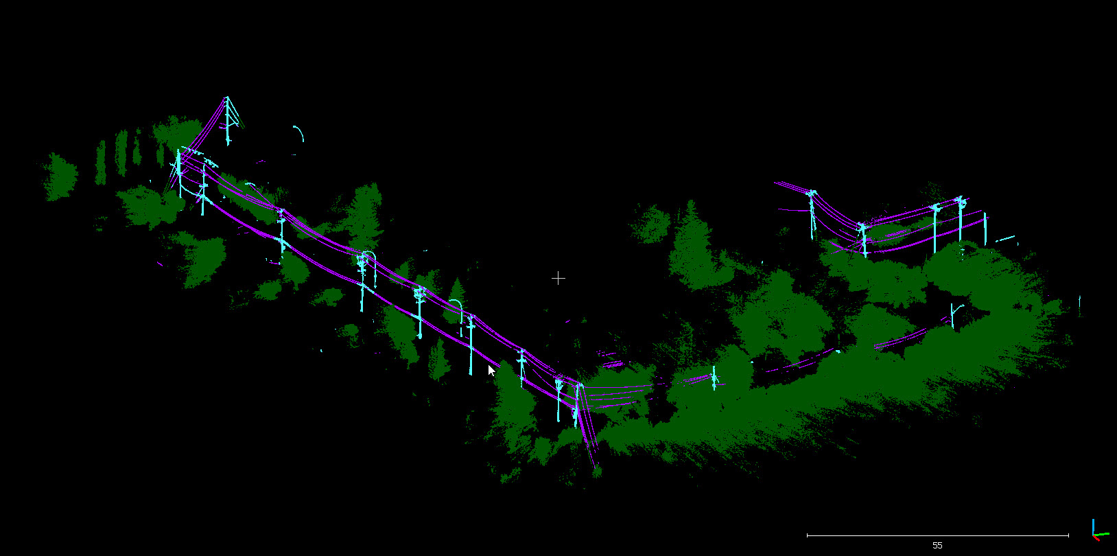
Powerlines
Electrical Boxes
Construction Equipment
Concrete Barriers
Structures
Buildings
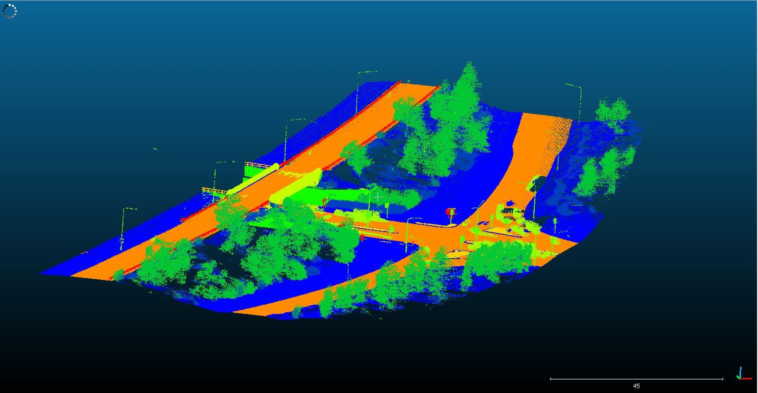
Bridges
Gantry
Noise
Scanning Artifacts
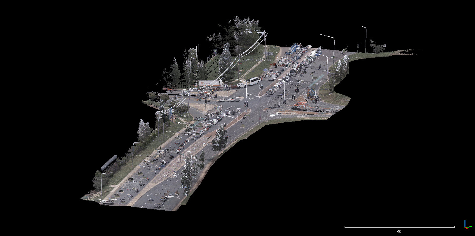
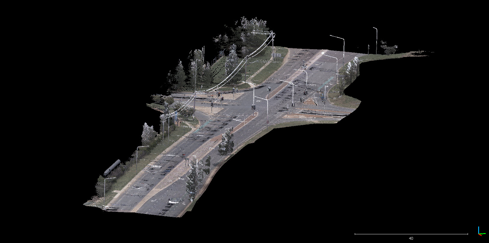
Vehicles
Pedestrians/Cyclists
Different Road Environments
Million Points
Classes
Data Compatability
Our models are trained to process data regardless of the scanning system or the sensor that was used to collect the data.
| Scanners | Scan Type |
| RIEGL | UAV |
| Trimble | Mobile LiDAR |
| Leica | Aerial LiDAR |
| Teledyne Optech |
Although higher point density results in more accurate results. The algorithms can be customized to process data with low point density
Applications and Use Cases
Guardrail Assessment
Noise and Vehicle Removal
Utility Powerline Extraction and Encroachment Analysis
Extraction of Bridge Structure and Other Elements
Extracting Multiple Features
Interested in a Free Demo?
Send us samples of your data today and we will send you the processed files for free.
Our team is also capable of annotating and training a model that is tailored to your datasets for improved accuracy.