
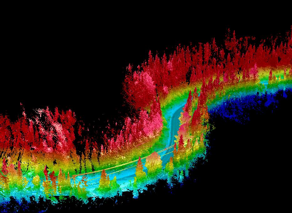
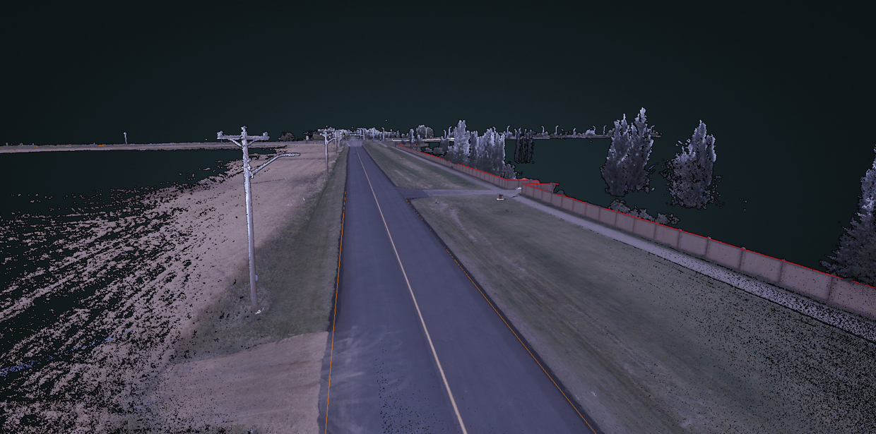
Infrastructure Digitization
We transform roadway infrastructure into digital models that are easily accessible from the comfort of your office.
Million Survey Points Collected Per Second
Points Per Square Meter
Degrees Field of View
Infrastructure Digitization
We transform roadway infrastructure into digital models that are easily accessible from the comfort of your office.
Million Survey Points Collected Per Second
Points Per Square Meter
Degrees Field of View
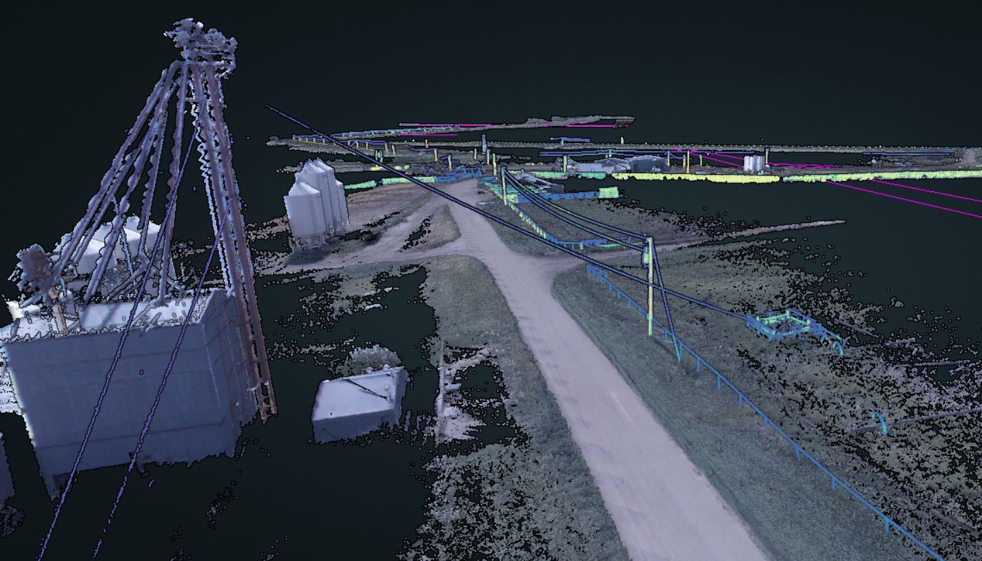
Easy Access to Highly Detailed 3D Models
Nektar 3D helps you create a 3 dimensional digital record of your infrastructure using a variety of different remote sensing techniques:
- LiDAR
- Street-Level Imagery
- Photogrammetry
This digital record is easily accessible using the Nektar GIS Platform.
We also utilize Artificial Intelligence and Machine Learning to provide advanced point cloud classification and data processing services.
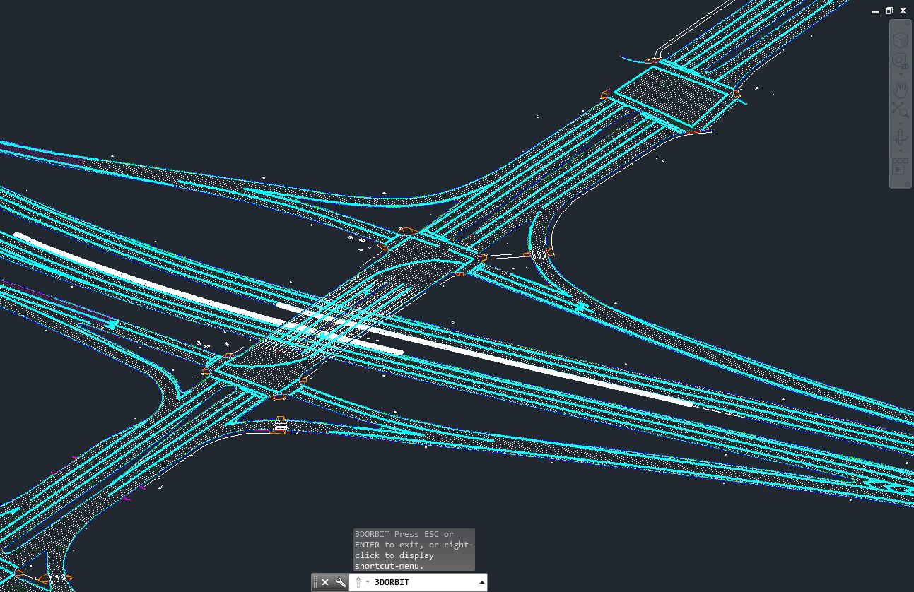
Our Services
We provide point cloud data collection and advanced data processing services to support transportation infrastructure and construction projects.
Data Collection
Using mobile LiDAR and Drone Technology to Collect Point Cloud Data
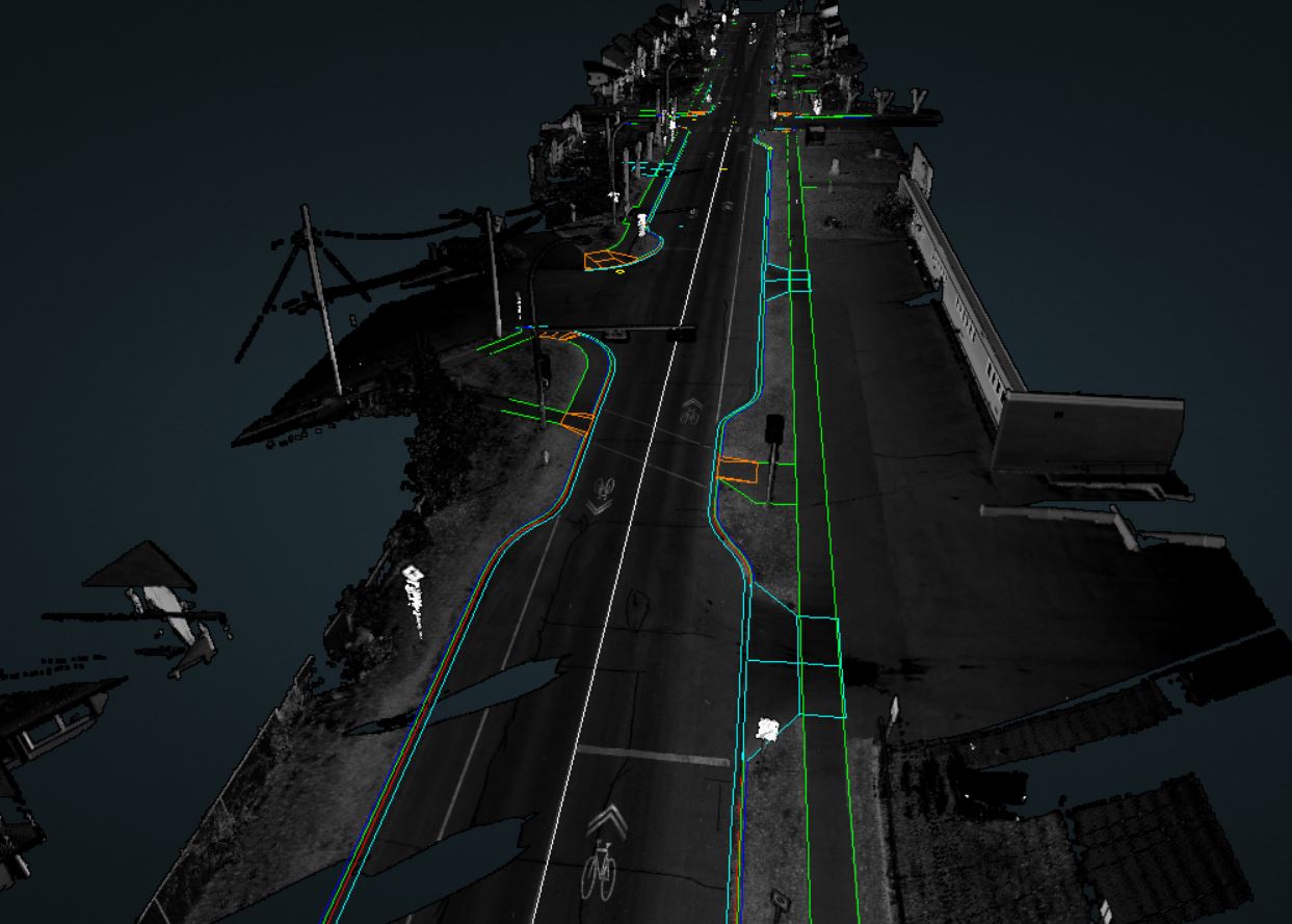
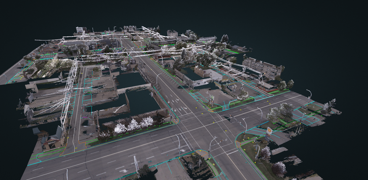
Feature & Attribute Extraction
Manage Assets and Extract Topographical Information from your Point Clouds
AI-based Classification
Automated High Quality Classification for 20+ Attributes
Our Services
We provide point cloud data collection and advanced data processing services to support transportation infrastructure and construction projects.
Data Collection
Using mobile LiDAR and Drone Technology to Collect Point Cloud Data
Feature & Attribute Extraction
Classifying LiDAR Data and Extracting Topographical Information from your Point Clouds
AI-based Classification
Automated High Quality Classification for 20+ Attributes
Industries We Serve
Construction
Using LiDAR and Photogrammetry to efficiently capture a virtual model of jobsite conditions, providing accurate construction quantity estimation, timely details of on-site conditions, and reducing construction delays.
View Relevant Projects
Infrastructure Mapping
Using LiDAR to create a digital twin of roadway corridors for efficient inventory and planning of above ground utilities and infrastructure assets including powerlines, traffic signs, utility poles, and slopes.
View Relevant Projects
Design
Efficiently conducting a LiDAR-based topographical surveys of site conditions to be used for preliminary and detailed design. This involves extracting details of curbs, sidewalks, and road edges and more.
View Relevant Projects
Planning
Using LiDAR to create a digital twin of roadway corridors for functional and concept planning projects through a virtual review of existing highway geometry including slopes, sight distances, guardrails, and more.
View Relevant Projects
Our Clients and Partners
![]()
Our Clients and Partners